Starship Technologies is building a fleet of robots to deliver packages locally on demand. To successfully achieve this, the robots must be safe, polite an...
Aerial mapping specialist Bluesky Ireland has announced plans to capture around 30,000 square kilometres of digital imagery. The Bluesky 2018 flying programme w...
Detailed 3D data captured using an aircraft-mounted laser is helping RPS Group plan, design and engineer a major overhaul of water supply in County Wicklow, Ireland. The Bluesky LiDAR data was used to assess various route options as water supply in t...
Bluesky Ireland has added around 30,000 square kilometres of geographic data to its online Mapshop. Now covering more than 70 percent of the Republic of Ireland...
Latest article from Henry Joseph-Grant, to see more click here
Waymo, Alphabet’s self-driving spinoff from Google, has asking a judge to block Uber from oper...
By @SimonCocking
Describe the PROJECT – the elevator pitch ...
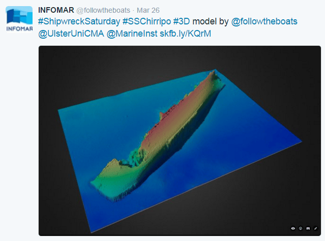
INFOMAR is a joint venture between the Geological Survey of Ireland (GSI) and the Marine Institute (MI), funded by the Department of Communications, Energy and Natural Resources. Th...